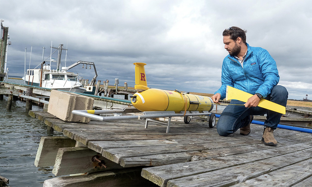
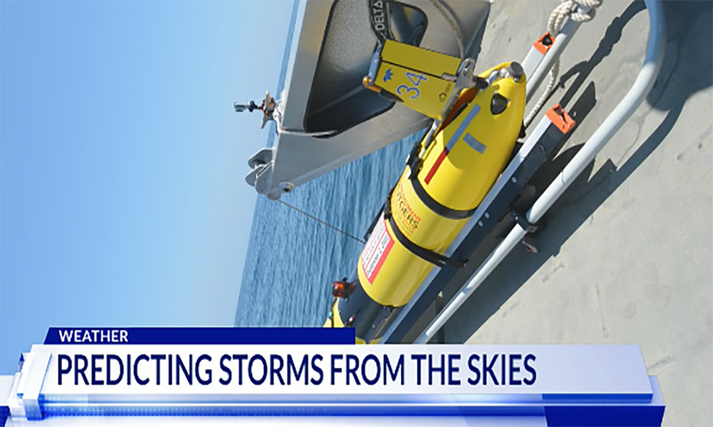
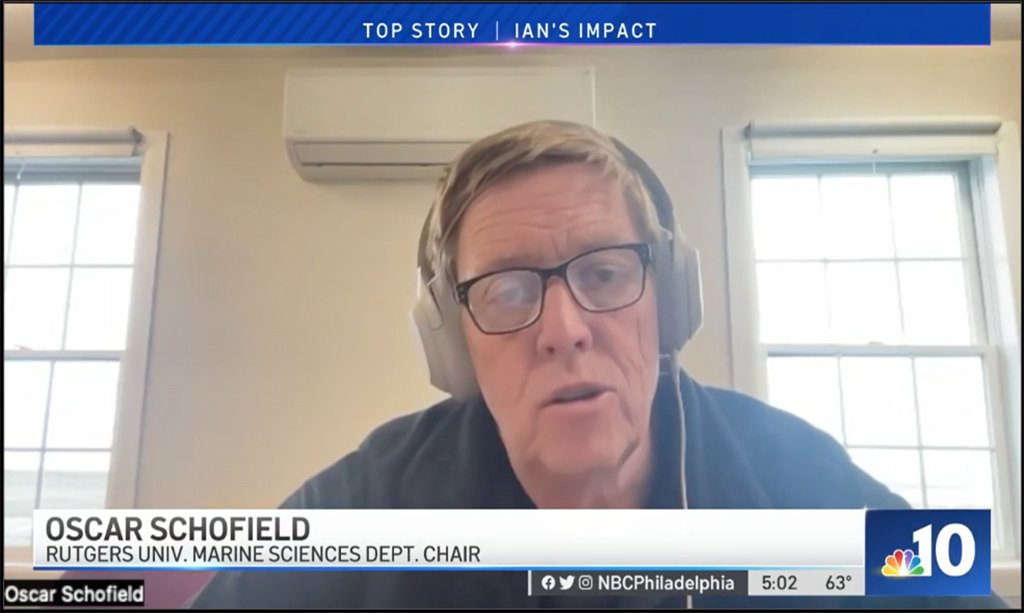
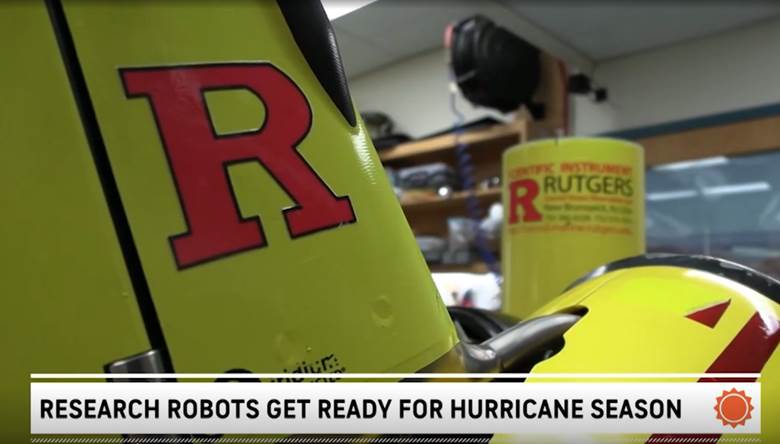
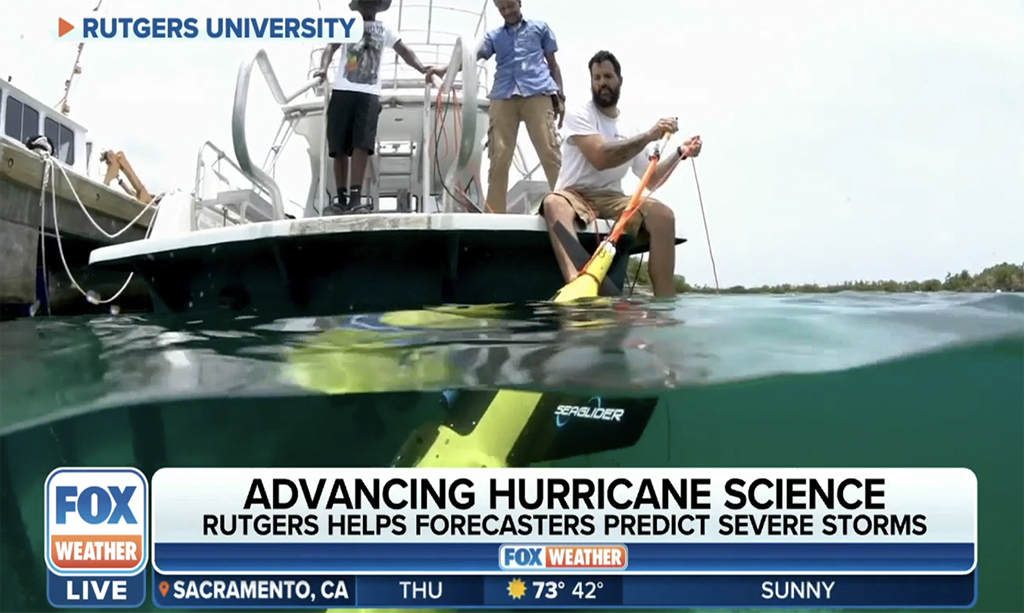
So have you ever wondered how meteorologists and weather forecasters predicted major storms weeks in advance? Well, ocean gliders that were originally used to help research ocean animals are now helping predict major storms. A group of professors at Rutgers University teamed up with workers at Orsted to help develop technology that will help determine weather patterns during hurricane season. Ocean gliders are used to help facilitate ocean modeling and storm forecasting these gliders, not only provide research about ocean animals but also measure sea temperatures is important when forecasting tropical storms. DC News Now sat down with a few members of the team to learn more about how this will change the way forecasters predict storms. “I was doing a mission. We said, well, let’s keep it out there. It doesn’t get seasick. You know, it’s going to collect data like we haven’t seen it and it really fundamentally changed the way that we look at the coupling between the ocean and the atmosphere. In the model,” Travis Miles, an Assistant Professor, with the Center for Ocean Observing Leadership at Rutgers University said. “Our main goal with them is to get improve our understanding of the intensity of hurricanes. So basically, the ocean is a heat engine,” Josh Kohut, a professor of Marine and Coastal Sciences, at Rutgers University mentioned. The company Ørsted decided to make its data public, submitting it to the NOAA’s Integrated Ocean Observing System and the Global Telecommunications System to support ocean modeling and storm forecasting. Original article at DC News Now

An NBC Philadelphia report on the effects of Hurricane Ian cancelling Chowderfest in LBI features Oscar Schofield (SEBS) discussing how sea level rise is fueling stronger storms. Full video at NBC Philadelphia

Dr. Travis Miles was interviewed by AccuWeather yesterday discussing the uses of Rutgers underwater Slocum gliders towards forecasting hurricane intensities at landfall. The coastal ocean temperatures play an enormous role in the intensification of deintensification of tropical cyclones as they approach our coasts. Gliders acquire data from the ocean surface to the ocean floor, and can swim right under the eye of a tropical cyclone without any issues, delivering data back to us on land that we send to forecast models to help improve their accuracy. To see Travis in action, visit: https://www.accuweather.com/en/videos/special-robots-glide-in-hurricane-waters-to-help-with-forecasts-research/FhVlOdYn

Forecasters from the National Weather Service met with Rutgers’ graduate student Casey Jones this past February to discuss career paths within their agency.  The National Weather Service is tasked with providing weather forecasts and warnings of hazardous weather for the protection of life and property to enhance of the national economy.  Casey is presently a student in the Masters of Operational Oceanography program within the Department of Marine and Coastal Sciences.  Casey met with Lead Marine Forecaster Sarah Johnson as well as Science and Operations Officer Brian Haines.  They both shared their career experiences working in the agency.  They also described entry level and internship opportunities for Casey to pursue with the Weather Service. Dr. Hugh Roarty also participated in the call and is an advisor for the current masters class of students.

Congratulations to RUCOOL grad student Sam Coakley on successfully completing his Masters defense entitled “The evolution of a stratified upper ocean under tropical cyclone forcing.” Sam will be moving on to work at the US Climate Variability and Predictability Program. Well done Sam, and we wish you the best of luck!

Travis Miles (lead author) and Scott Glenn partnered with dozens of other scientist on this paper that provides a broad overview of the ongoing US hurricane glider project and details of a new effort with the Saildrone USV during the 2021 hurricane season. While this article focuses on the US East Coast, Gulf of Mexico, and Caribbean Sea, similar efforts are underway in Korea, the Philippines, Japan, and China, among other countries. The full article is available at: https://tos.org/oceanography/article/uncrewed-ocean-gliders-and-saildrones-support-hurricane-forecasting-and-research

Researchers from Rutgers are analyzing the response of the ocean to the recent passage of Tropical Storm Elsa.  The storm was modelled in real time by the Rutgers Weather Research and Forecasting model (RUWRF).  The animation shows the surface winds as the storm moved past the Jersey Shore.  The ocean surface currents were captured by the MARACOOS High Frequency Radar (HFR) Network which is supported by U.S IOOS.  The animation shows the surface currents along with the 6-hour best track of the storm from the National Hurricane Center.  The best track was interpolated to hourly positions to map to the update frequency of the HFR maps. Tropical Storm Elsa moved north along the coast in a track similar to Hurricane Irene in 2011.  Ahead of the eye the currents were onshore but weak.  The strongest currents were observed alongshore to the right of the eye as it moved past New Jersey.  This is in contrast to Hurricane Irene which displayed strong cross-shore currents and weak along-shelf currents (Glenn et al. 2016).