RUCOOL Ocean Model Evaluation Team

Scott Glenn

Board of Governors and Distinguished Professor

Travis Miles

Assistant Professor

Michael Smith

Data Analyst and Programmer

Lori Garzio

Research Analyst

Improving Hurricane Forecasts

Hurricanes, typhoons & tropical cyclones are among the most destructive natural events on Earth. Continued advances in hurricane science, leading to increased forecast accuracy and lead times, is required to promote more timely and effective hurricane responses that save lives, property and livelihoods.

Hurricane Dorian at 8:35 a.m. EDT, Sept. 6, 2019.
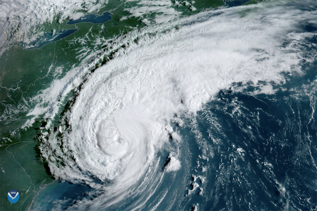
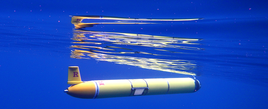
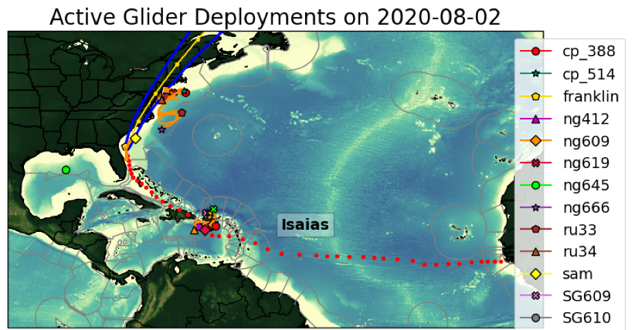
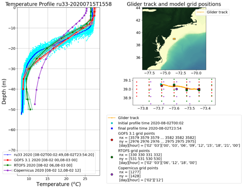
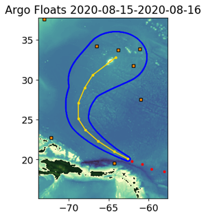
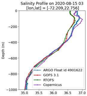
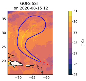
In the last two decades the National Weather Service has recognized the need to improve their hurricane intensity forecasts in order to better guide the response of coastal communities during storms. Hurricane forecasting models require accurate ocean and atmosphere initial conditions to better forecast hurricane intensity. These initial conditions are created be assimilating many diverse datasets including those from numerous satellites, Argo profilers, CTD deployments from ships and remote platforms, ocean drifters, and ocean gliders. These ocean datasets not only give modelers an accurate initial condition for their models, but also allow them to later evaluate the accuracy of the models, enabling them to improve the model accuracy.
The work here focuses on comparing multiple model forecasts/nowcasts to in situ datasets that will enable modelers to evaluate their model’s accuracy. Initial work through summer 2020 focused on model comparisons to ocean gliders, but we are expanding comparisons to surface drifters and Argo profilers.

Model/Data Comparisons

The directories below house images and analyses of glider comparisons to ocean models. Model/data comparisons for 2019 and 2020 are searchable by year, month and day.

2018

2019

2020

2021

The images in the above directories are described in detail below.

This is a map of the North Atlantic basin showing the gliders reporting data to the IOOS Glider DAC on that date. When a storm is present, the map will also show the storm best track (red dots), the forecasted track (yellow dots) and the cone of uncertainty (blue oval).

This is a plot of temperature profile for glider RU33. We provide corresponding temperature and salinity profiles for all gliders reporting to the IOOS glider DAC. We compare these glider profiles to the nearest model grid vertical profiles for three global operational ocean models: Global Ocean Forecasting System (GOFS 3.1), Real Time Ocean Forecasting System (RTOFS) and the Operational Mercator Global Ocean Analysis and Forecast System (Copernicus).

In addition, in the mid-Atlantic region (Cape Hatteras to Cape Cod) we compare glider data to the Doppio Model, and in the Caribbean we compare the glider data to the American Seas Model (AmSeas). The directories with these data are listed as separate sub directories within each daily analysis.

When a storm is present, we provide additional comparisons between the temperature and salinity profiles from Argo floats nearby the forecasted track, and compare them with vertical profiles from GOFS 3.1, RTOFS and Copernicus. We also provide different surface and subsurface fields, e.g. sea surface temperature and temperature at 200 meters depth, for the same global ocean models.