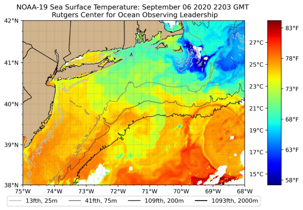
Satellite data gives scientists a comprehensive view of the ocean surface over the entire Earth. NASA, NOAA and other international agencies have been operating numerous satellites focused on studying ocean dynamics for over four decades. Many of these agencies make global datasets freely available to the public, however, the data are often delayed, or spatial ground resolutions are too small to see the details of our coastal ocean dynamics. Rutgers has been operating its satellite ground station since 1992, downloading data directly from satellites and generating near real-time data for our scientists to use to study ocean physics, biology, chemistry and geology, with many products geared specifically to study the mid-Atlantic.
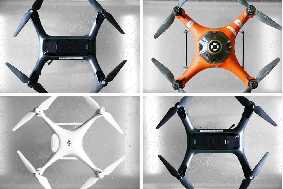
Unmanned aircraft systems (UAS) are a new type of platform that are starting to become part of oru ocean observing system. UAS are poised to revolutionize marine science and conservation as they provide on demand remote sensing at low cost and reduced human risk. Aerial imagery has been utilized to map coastal marine debris which can pollute ecosystems and pose a hazard to navigation.
RUCOOL Contributions
In late 1994, Rutgers began distributing Sea Surface Temperature (SST) data to the public on our website in 20 regions from Mexico to Newfoundland and everything in between. The SST data has been used to study fisheries, plan forecast beach temperatures, improve hurricane intensity forecasts, plan for sailboat and ship navigation, assist energy companies on coastal draw down forecasts, and create water mass tagging products. Today we have expanded well beyond our SST products, working with our partners in MARACOOS, we deliver over 30 products available in near real-time, and with a 30 year dataset, we are enabled to study long term changes in our climate.
RUCOOL has recently begun utilizing a fleet of four Unoccupied Aircraft Systems (UAS) or drones as platforms for our research. The platforms have been evaluated by local lifesaving organizations as vehicles to deliver emergency flotation to swimmers in need, and will be used in an upcoming field experiment to quantify the amount of floating Sargassum in the coastal waters around Puerto Rico.
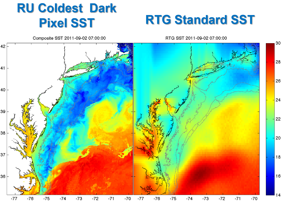
The Rutgers University coldest pixel sea surface temperature product is unique in its ability to capture certain common features in the Mid-Atlantic Bight, in particular upwelling and strong storm mixing, differing from standard products in both the declouding algorithm and the method of compositing. This product is currently generated using AVHRR data but will be converted to be applied to GOES data in 2021.
RUCOOL Satellite imagery identifies cold shelf surface water after the passage of a hurricane while standard government products do not.