Hurricane Research Gliders Launched from Monmouth Vessel
With the 2020 hurricane season officially underway, the UCI partnered with a team of federal agencies and research institutions to deploy a pair of Navy research gliders that will shed…
With the 2020 hurricane season officially underway, the UCI partnered with a team of federal agencies and research institutions to deploy a pair of Navy research gliders that will shed…
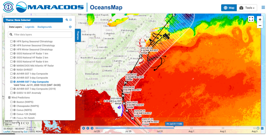
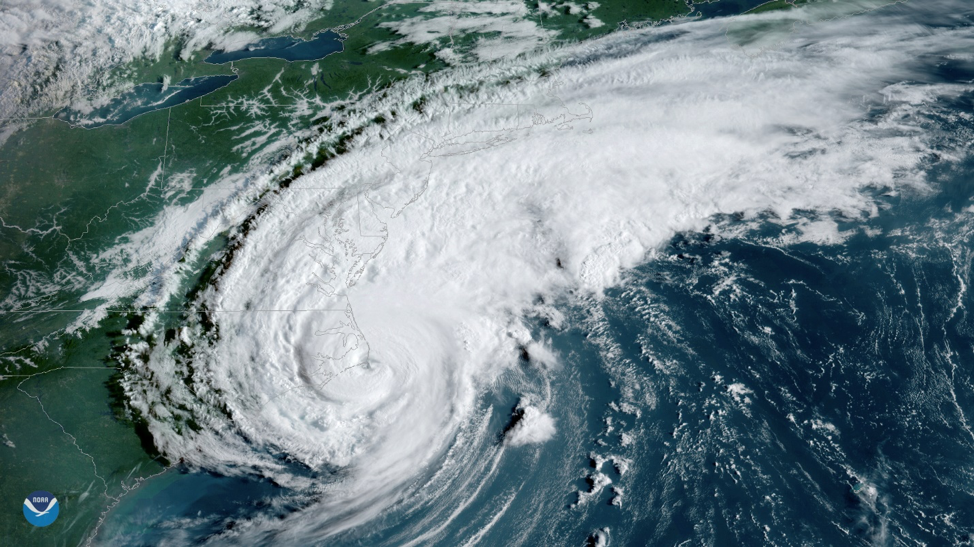
The MARACOOS team and our partners have been preparing for the pending arrival of Hurricane Isaias, currently forecast to hit the Mid-Atlantic on Monday night. Ocean observations contribute to improved…
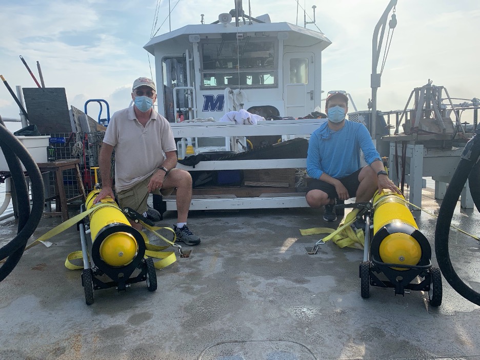
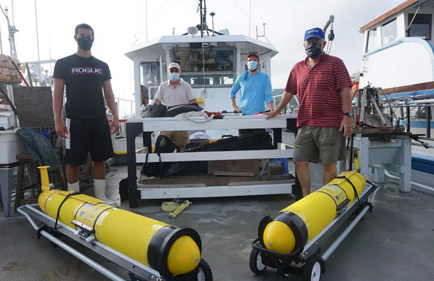
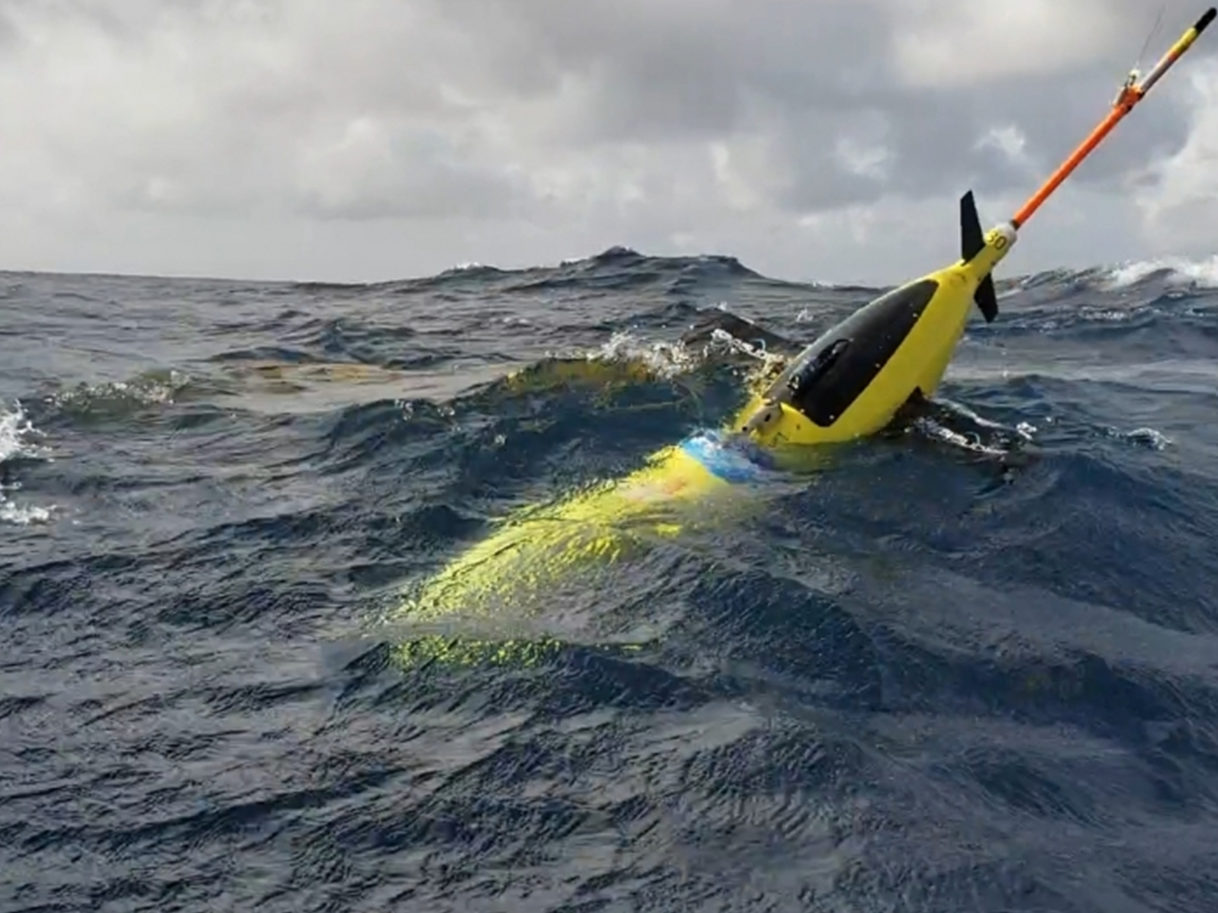
Scott Glenn and Travis Miles joined captain Jim Nickles of Monmouth University on the R/V Heidi Lynn Sculthorpe on July 22 and deployed two US Navy Slocum Gliders. These gliders…

The Jersey Shore is endeared in our minds as a mystical convergence of beach, ocean, boardwalk and amusements—punctuated with sounds of seagulls and crashing waves—and seasoned with smells of salty…

The influences of ocean conditions and currents on living environments are now more widely appreciated—from the Earth’s climate and severe weather conditions to fisheries and biodiversity. Sustained and wide-spread measurements…
The need for the improvement of the hurricane intensity forecasts has been recognized by groups within the National Weather Service (NWS) and US Navy. Hurricane forecasting models require accurate ocean…
NOAA | News & Features Four ocean gliders are setting off to sea this week to bring back data scientists hope will improve the accuracy of hurricane forecast models. The…