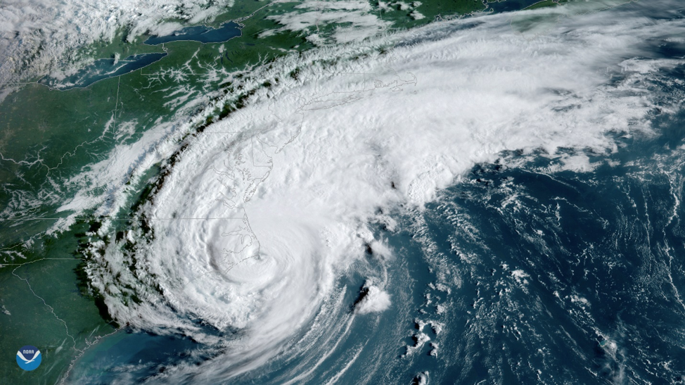
The need for the improvement of the hurricane intensity forecasts has been recognized by groups within the National Weather Service (NWS) and US Navy. Hurricane forecasting models require accurate ocean and atmosphere initial conditions to better forecast hurricane intensity. One way to improve the initial conditions in operational ocean models is to use data assimilation, a technique that allows a numerical model to ingest observational data to nudge the model predictions closer to reality. RUCOOL is evaluating how data assimilation is impacting the ocean model performance throughout the western Atlantic Ocean and ultimately how ocean processes affect storm intensity. Images of these daily model comparisons, since the inception of the 2019 hurricane season, are available here.
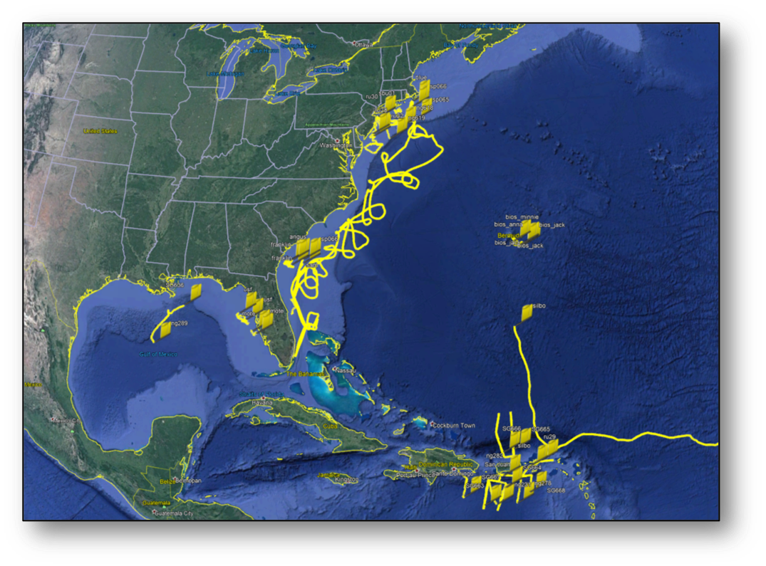
The Rutgers gliders are part of a larger fleet that is deployed throughout the western Atlantic with partners from the Navy, MARACOOS, CARICOOS, SECOORA, GCOOS and AOML to monitor sea surface temperatures and collect other data during hurricanes. This work is funded through several projects with NOAA (IOOS, OAR, AOML), the US Navy, NSF, the states of NJ and NY, private companies and private donations. A map of the 2019 hurricane season glider deployments from all partners is shown below. The data from these gliders is available for download through the IOOS Glider DAC.
For weekly updates on the glider research, status of missions, etc, please visit the RUCOOL Hurricane Blog.