IOOS has selected a limited number of volunteers at marine WFOs to evaluate the utility of HF radar-derived significant wave height (SWH) and direction in daily marine forecasts. This is a new data product that will be created and delivered by IOOS academic partners in near-real-time. Pilot projects in several coastal areas are envisioned that should last at least 6 months. At the end of the pilot projects, the NWS AFS should be able to decide whether this new data product has utility for marine forecasting.
A National Operational Wave Observation Plan calls for 133 wave sensors in the Coastal Subnet while only 67 are currently deployed. There is potential for some of the 160 HF Radars currently deployed to fill that gap. Surface gravity waves have a profound impact on navigation, offshore operations, safety and economic vitality of the nation’s maritime and coastal communities.
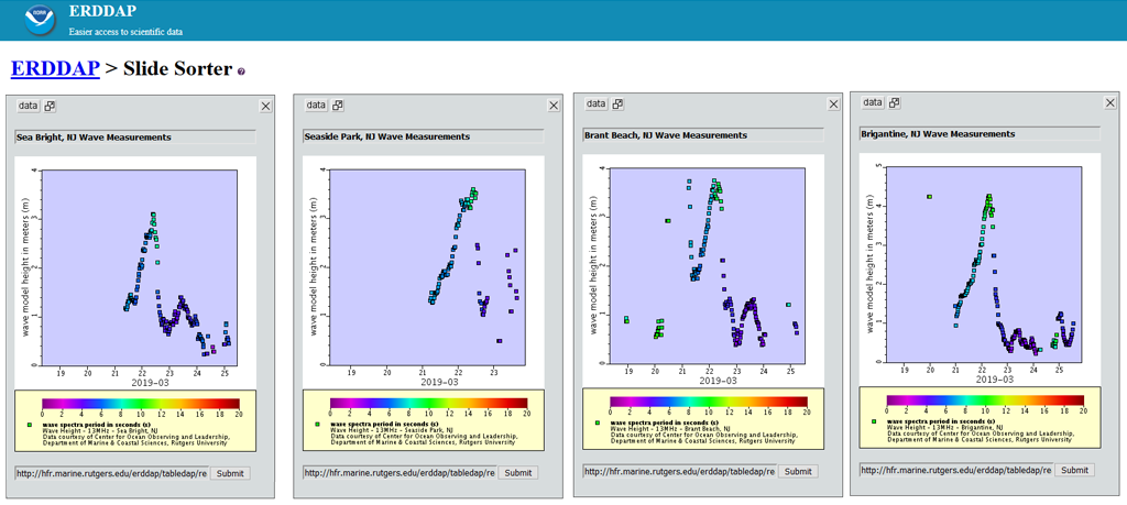
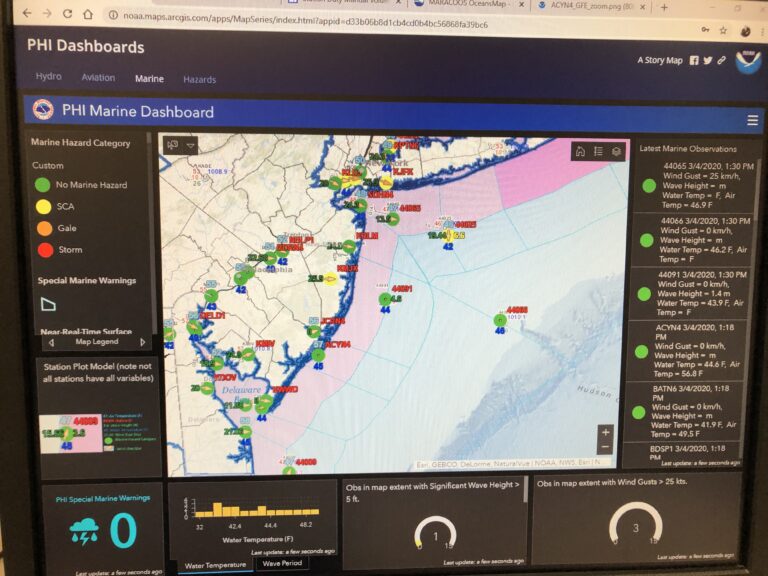
Plots of the most recent 7 days of wave measurements are available for viewing here and available via ERDDAP here.
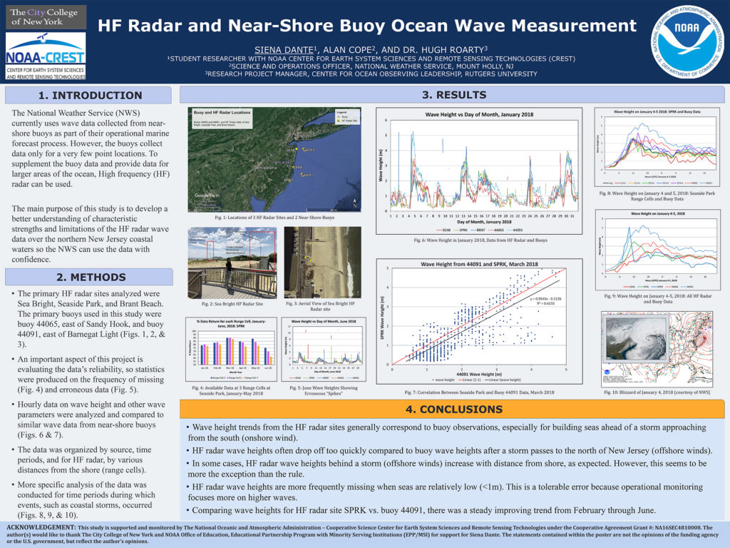
Siena Dante, a junior at City College of New York presented a poster at the 2018 CUNY CREST Summer Research Symposium on this topic.
Download pdf version.