Title: Software Tools for the Mitigation of Wind Turbine Interference in the U.S. IOOS Network
Funding Agency: NOAA IOOS
Project Lead: Hugh Roarty
Partners: CODAR Ocean Sensors
University of California Santa Barbara
Woods Hole Oceanographic Institution
Period of Performance: June 2020 – May 2023
Total Budget: $59,587
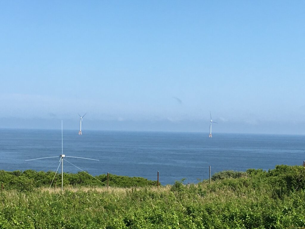
Project Summary: The rapidly emerging U.S. offshore wind energy industry will both require new environmental data and data aggregation that IOOS is uniquely positioned to provide as well as disrupt existing sensing systems that IOOS supports. A significant adverse consequence of the likely installation of 100s of wind turbines over the outer continental shelf (OCS) within the next 3-6 years is the disruption of ocean current observations from land-based high frequency (HF) radar systems. As a core IOOS operational dataset, wind turbine interference (WTI) on the distributed surface current observations managed by the National HF Radar Network would render them blind within large areas of the coastal ocean.
Mitigating the effects of spinning turbines on HF radars is a difficult, but solvable, problem. Initial efforts have established: (1) the mechanism by which turbines can interfere with HF radars, (2) the potential effects of the interference on accurate measurements of surface currents over broad areas of the radar’s coverage, and (3) the likely pathways to mitigate the interference for small numbers of turbines (Trockel et al., 2018). However, the offshore wind industry will rapidly outpace these simplified methods and thus a robust, permanent mitigation solution is needed.
The proposed work will leverage an ongoing, limited software development project funded by BOEM, and conduct a coordinated set of system integration, testing, validation, and verification activities needed to advance the technology through RL 9. The proposed work addresses the limitations of the BOEM study through planned efforts that will: (1) collect WTI data at the frequencies/ranges missing from previous efforts; (2) develop and utilize a focused dataset of simulated, hybrid, and observed WTI and conduct detailed mitigation methodological testing; (3) document operational changes of the networked IOOS-radar systems that will increase the accuracy of mitigation methods; and (4) conduct a full scale, in situ validation of mitigation methods at the first major U.S. offshore wind farm.
Both the BOEM software effort and transition work proposed here dovetail with the recommendations of an IOOS-tasked community working group. Paired together, these efforts will fully advance HF radar WTI mitigation of surface current observations from research into regular operations. The combined efforts will result in validated software operating on HF radar site computers, enabling radars to observe ocean currents in and around operating offshore wind farms.
HF radar is a critical component of the IOOS mission and the only instrument capable of making both high spatial and temporal resolution observations of surface currents over the continental shelf. The plan outlined here will meet the challenges presented by offshore wind development and ensure the continued viability of this essential IOOS data product. Without efforts to prevent it, large areas of existing HF radar coverage, which are strategically important precisely because they coincide with potential offshore wind farms, will be lost as more turbines come online.