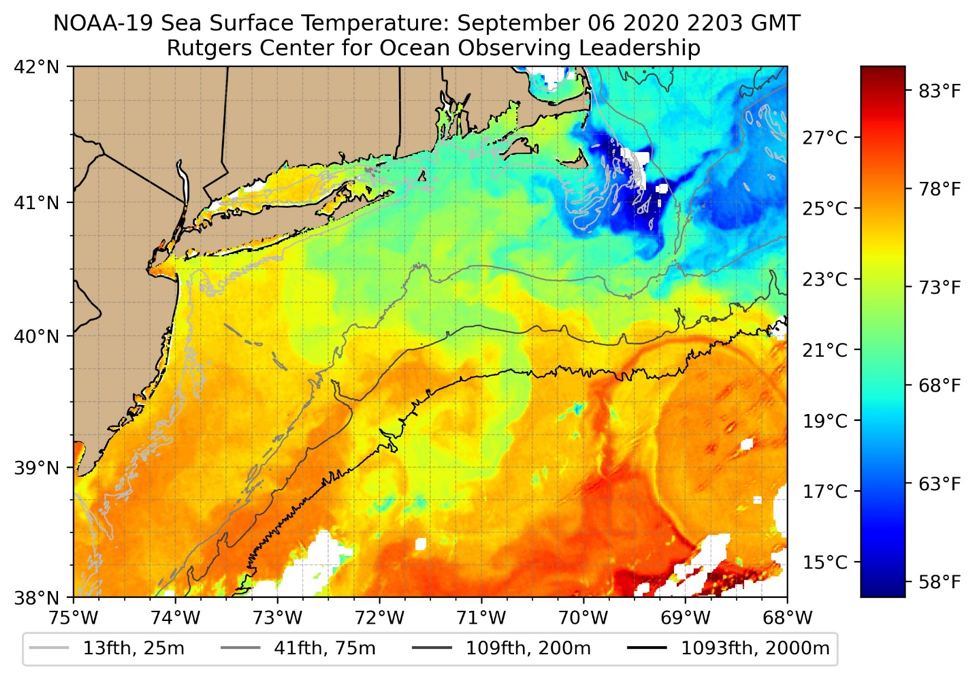
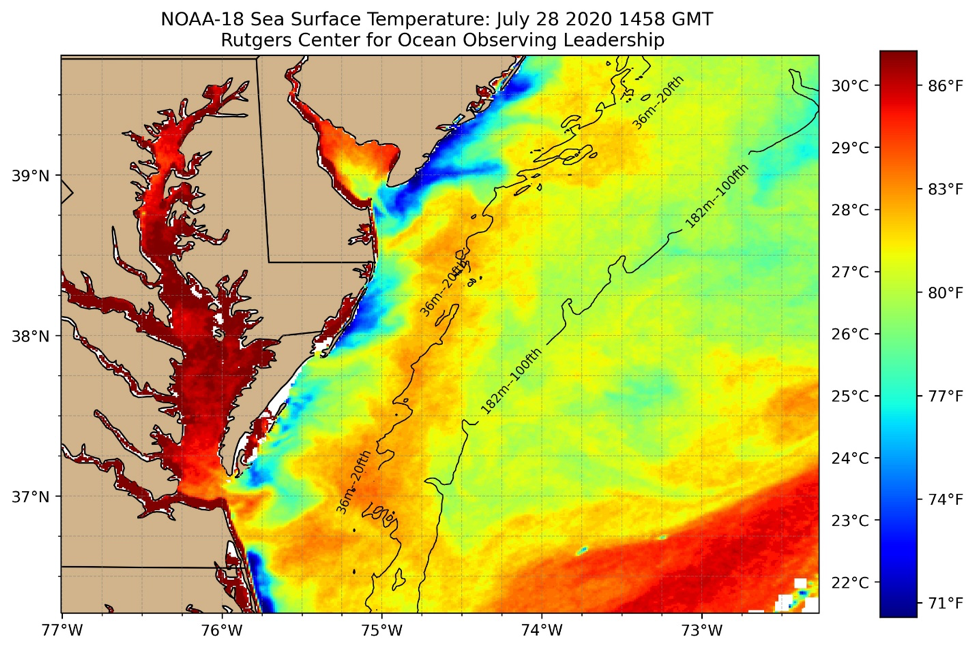
RUCOOL has been delivering real-time imagery to its website since 1994. This month we are introducing a new faster and easier to use viewer for all new and archived imagery, which is located here. Not only has the front end GUI been updated, but so have the images themselves. The new images have higher resolution detail throughout all of the 23 sea surface temperature geographic areas.
Through the fall of 2020, we will continue to generate both the new and old imagery, as well as maintain the both the new GUI and the existing pages here. Once the northeast US fishing and beach season concludes later this year, we will take down the old site and stop producing the older imagery format.
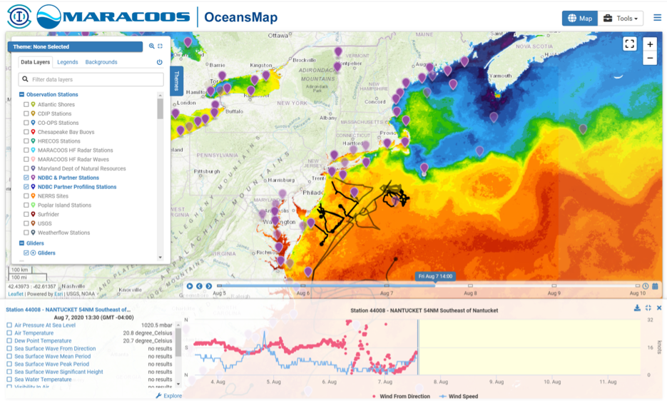
Additionally, we wanted to make you aware of the Mid-Atlantic Regional Association Coastal ocean Observation System’s (MARACOOS) OceansMap viewer. This state-of-the-art interactive system not only has the capability to display satellite data, but also data from over 100 different sources, including hurricane tracks, winds, currents, forecasts, station and buoy locations. Users can interact with the map clicking to see the latest temps, wind speeds, wave heights, etc. RUCOOL is proud to be part of the MARACOOS team.
We thank the thousands of you that have used our data over the last quarter of a century, and look forward to providing you satellite imagery and ocean data for years to come.