Can Penguins Help Teach Kids About Climate Change? New Research Says Yes
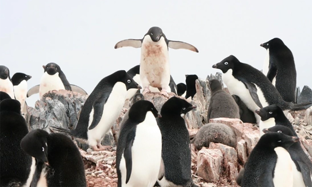
Penguins waddling across Antarctic ice might seem far removed from a classroom in New Jersey, but a new study shows that these charismatic birds can be a powerful hook for…
Penguins waddling across Antarctic ice might seem far removed from a classroom in New Jersey, but a new study shows that these charismatic birds can be a powerful hook for…
Fiorella Prada has been named the SEBS Teacher of the Year. Fiorella was chosen by the Alpha Zeta SEBS Honors Professional Fraternity Award presented by SEBS at baccalaureate ceremony later…
On behalf of the Center for Advancing Research Impact in Society (ARIS), it is my pleasure to share that you have been awarded the 2026 ARIS Enduring Achievement Award! Your…

Rutgers researchers have made a discovery that could change the future of seafood farming in New Jersey. A study led by marine scientist Daphne Munroe has shown that Atlantic surfclams can…

MS of Operational Oceanography (MOO) students recently visited Ocean Power Technologies (OPT) in Monroe, NJ to learn about OPT’s diverse marine technologies and their applications. The visit was hosted by…

New Brunswick, NJ — Rutgers University is supporting Memorial University of Newfoundland’s Lab2Market Oceansprogram by contributing operational expertise and direct practitioner insight to the program’s customer discovery activities. As part of…
TRENTON – New Jersey LCV will host its 12th Annual Gala on Monday, June 15th at 5:30 p.m. at the Palace in Somerset, N.J. The Gala celebrates pro-environment victories and…