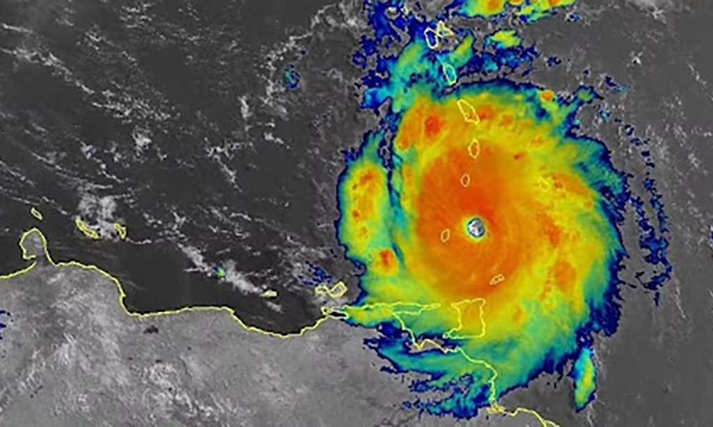
In early July, the Caribbean experienced 165 mph winds as Category 5 Hurricane Beryl swept through the region. Beryl was unprecedented, becoming the Atlantic’s earliest forming Category 5 tropical cyclone on record. The storm developed and rapidly intensified to maximum wind speed in less than four days – a behavior uncommon this early in the season. Despite the unprecedented intensification, hurricane scientists and oceanographers with NOAA were prepared. Researchers collaborated with multiple partners to sample Beryl from top to bottom, providing invaluable data to safeguard life and property while also aiding future research to unlock complex tropical cyclone processes.
To better understand Hurricane Beryl, scientists observed the storm from the sea, sky, and space with an array of observational instruments to gain a comprehensive perspective of the storm’s behavior and dynamics. Data from these instruments were assimilated into weather models and used by the National Hurricane Center for more accurate track and intensity forecasts.
Ocean temperature and salinity features influence a hurricane’s ability to pull deeper waters upward that cool the surface ocean, an interaction known to impact storm development and intensity. An underwater glider deployed by Rutgers University’s Center for Ocean Observing Leadership, RU29, was near Beryl’s projected path and, as Beryl approached, was moved to inside the forecast cone. Soon after, the storm crossed directly over the glider, collecting measurements below the hurricane’s eyewall. This is believed to be the first time a glider has been beneath the eyewall of a category-5 hurricane. As the glider made frequent dives to depths over 1500 feet, unprecedented data revealed how Beryl mixed, cooled, and changed the ocean below. The data were submitted in real-time to the U.S. IOOS National Glider Data Assembly Center for immediate use in forecast models as well as research.
Full article at NOAA Research