-
Michael Gulf of Mexico SST anomaly and ocean response
Posted on October 11th, 2018 No comments
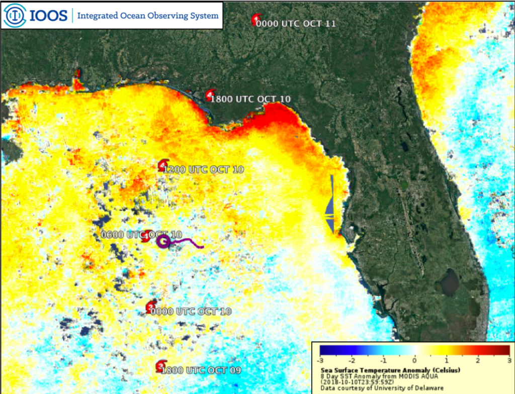
Micahel is now making its way through the Carolinas and into the Northeastern part of the country. It looks like it had a truly devastating impact of the Florida panhandle region coming ashore as a category 4, a few miles per hour shy of a category 5. Some of the rapid intensification is likely due to warm sea surface temperatures in the Gulf of Mexico. Above is a plot of the 8-day composite sea surface temperature anomaly after removal of the 15 year average for the same time period. This product is generated by the University of Delaware Ocean Remote sensing and Biogeography (ORB) Lab. Above average temperatures are clearly visible in the northern portion of the Gulf where the storm intensified.
Additionally, this image shows a glider track in purple for the US Navy Glider NG288, which we’ve been following for the past few blog posts. The system collected data throughout the storm, transmitted it to shore where the Navy made it available to IOOS for public release.

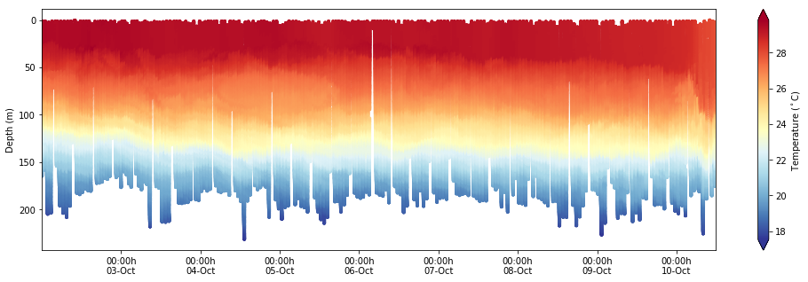
In the time and depth slice from NG288 it’s clear that surface layer was very warm, exceeding 28 Celsius down to about 50 meters ahead of the storm.This thick warm surface layer provided an ample pool of heat to maintain and intensify Michael as it approached land. On October 10th, as the storm passed over the glider location there is rapid mixing and deepening of the surface mixed layer from 50 meters down to almost 100 meters, but with very limited ocean cooling. This is an exciting dataset that we’ll be using for years to come to understand rapid intensification of hurricanes in the Gulf of Mexico.
Last 5 posts by Travis Miles
- Sally Approaching SG601 - September 13th, 2020
- Coupled Modeling of Fay - July 12th, 2020
- Hurricane Michael glider model comparisons for October 9th - October 10th, 2018
- Navy Glider Model Comparisons for Hurricane Michael - October 8th, 2018
- Isothermal shelf waters and Florence - September 14th, 2018


