


-
Navy Glider Model Comparisons for Hurricane Michael
Posted on October 8th, 2018 No comments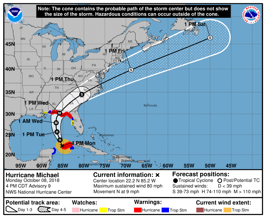
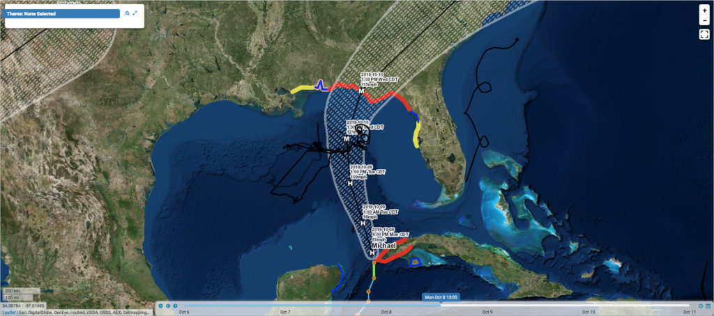
The Atlantic Hurricane season is not over yet. Hurricane Michael has recently spun up in the Caribbean Sea and is making its way into the Gulf of Mexico. There are still a number of gliders in the east coast, Caribbean, and Gulf of Mexico picket line out there. Navy Glider NG288 is positioned just to the right of Michael’s predicted track, where winds, waves, and ocean mixing are likely to be the highest. A plot of the NHC storm track and glider track (in black) is shown below from the MARACOOS Oceansmap Data Portal
Maria, our IOOS research analyst, has generated the usual glider data/model comparison profiles for the last day from Navy HYCOM GOFS 3.0 and 3.1.
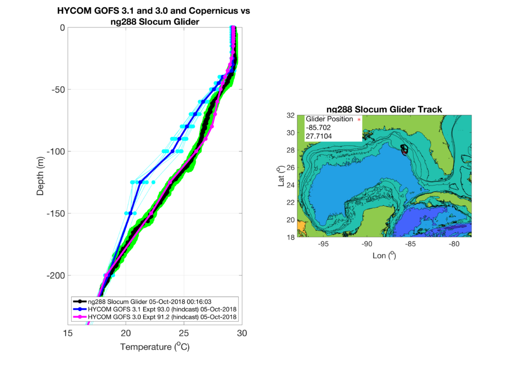
In the left panel: individual glider data profiles are shown in green with the daily mean in black, GOFS 3.0 only archives daily and is plotted in magenta, and GOFS 3.1 profiles are every 3 hours and plotted in light blue with the daily average in dark blue. In the upper 30 meters both GOFS 3.0 and 3.1 are in good agreement with glider observations with temperatures all near 29 Celsius. Below 30 meters depth the models diverge, with GOFS 3.0 following the glider profiles closely throughout the water column. GOFS 3.1 remains a few degrees cooler than the glider and 3.0 until about 200 meters depth. The heat content, defined as the depth integrated heat above the 26 degree isotherm, for GOFS 3.1 is going to be lower than the glider or GOFS 3.0.
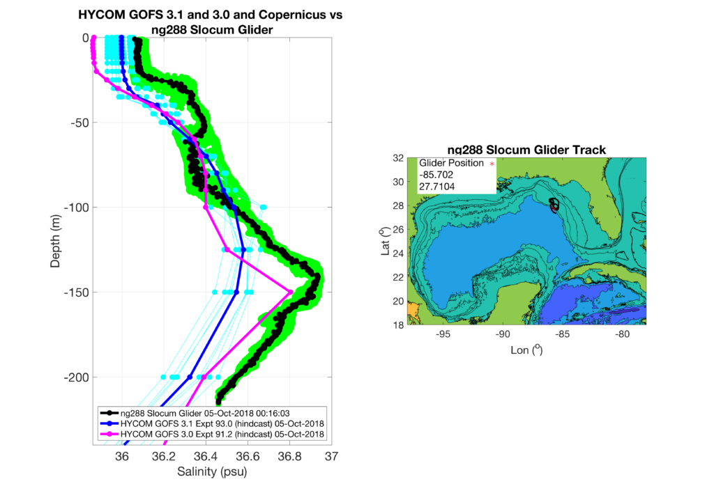
Both models are fresher than the observed salinity profiles throughout the water column, with GOFS 3.1 being closer to observations in the surface, and GOFS 3.0 closer near the salinity maximum at ~150 meters depth.
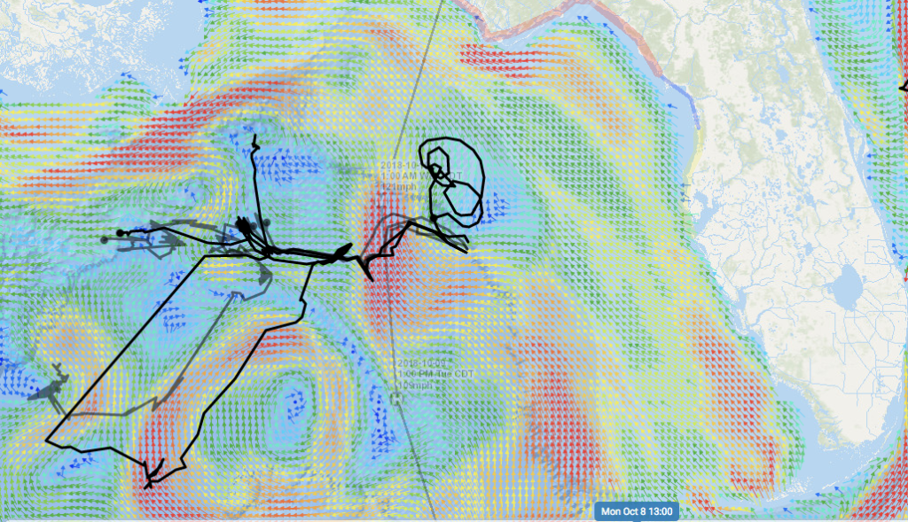
A snapshot of surface currents from Navy HYCOM in MARACOOS Oceansmap shows that a warm core loop current eddy is located just to the west of the storms predicted position at 1:00 PM CDT Tuesday October 9th. The glider is located in a frontal region near the storms predicted position at 1:00 AM CDT Wednesday October 10th, with slow currents to its east and fast northward currents to its west. The uncertainty in model data comparisons may be related to the placement of these features in the different models, and will require further investigation.
Last 5 posts by Travis Miles
- Sally Approaching SG601 - September 13th, 2020
- Coupled Modeling of Fay - July 12th, 2020
- Michael Gulf of Mexico SST anomaly and ocean response - October 11th, 2018
- Hurricane Michael glider model comparisons for October 9th - October 10th, 2018
- Isothermal shelf waters and Florence - September 14th, 2018
