-
Hurricane Iota
Posted on November 16th, 2020 No commentsJust a quick placeholder post as we approach the winter analysis phase. Yesterday’s forecast for Iota intensification looks to be happening today. Looks like the hurricane forecasters are making good use of the HWRF guidance. Their discussion was about high sea surface temperatures, low wind shear, and high moisture contents.
-
Hurricane Eta – Low Wind Shear, High SST
Posted on November 2nd, 2020 No commentsToday’s 10 am Discussion on the National Hurricane Center reflects a common theme:
"Low vertical wind shear and warm sea surface temperatures ahead of Eta are expected to
allow for continued rapid strengthening during the next 12 to 24 hours."
We see the forecasters are keying in on the relative impacts of vertical wind shear and sea surface temperature to help them turn the intensity guidance they get from decision aids into their intensity forecasts. Current shear and SST conditions are prompting the call for a Cat 4 hurricane:
"The updated NHC intensity forecast is above all of the
intensity aids and now calls for Eta to become a category 4
hurricane before it nears the coast of Nicaragua."
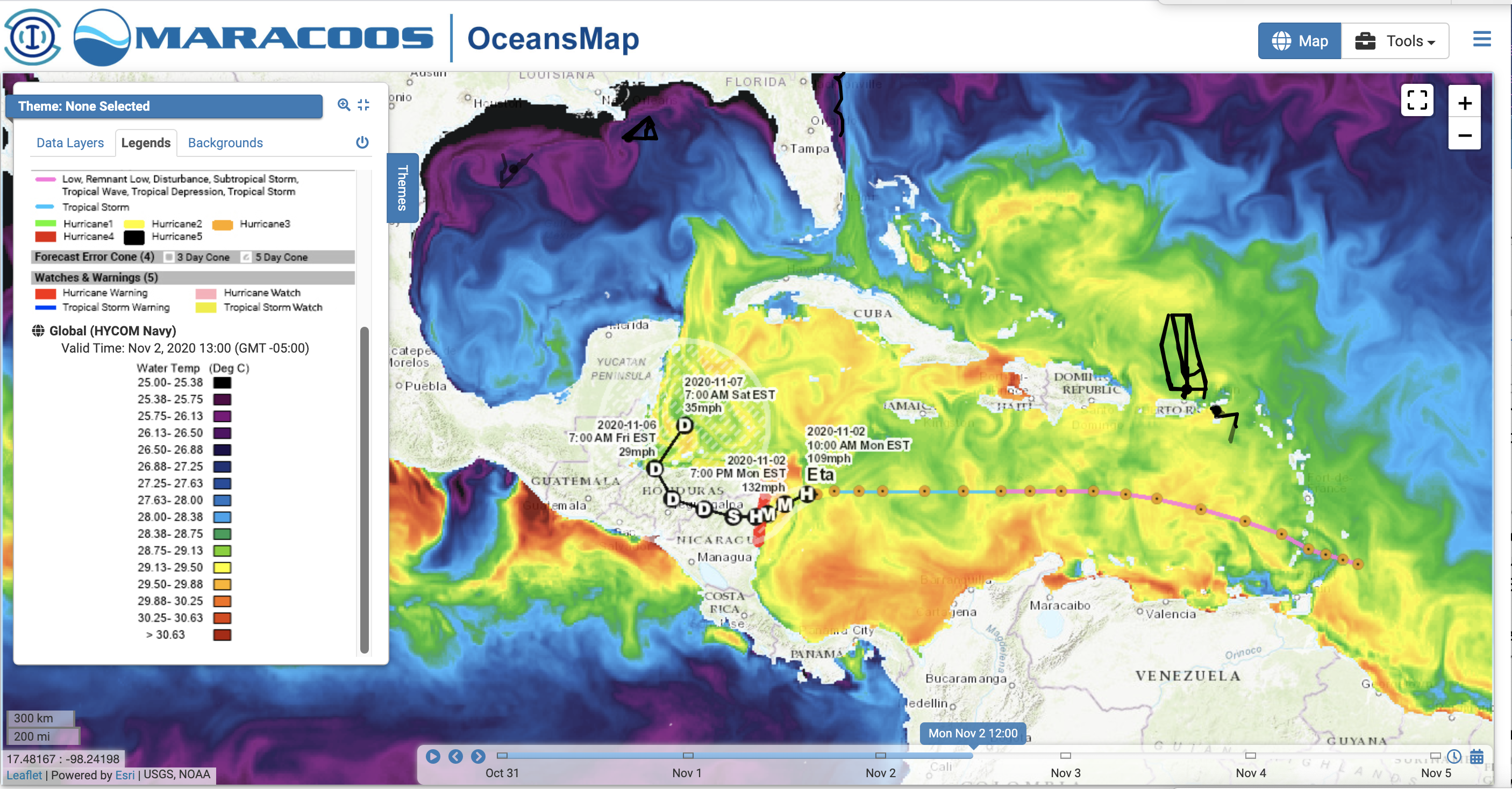
Step 2, lets look at those conditions in OceansMap. We see a rich mesoscale across the central Caribbean as Eta tracks from the Windward Islands to Nicaragua. Even the green colors in this image are above 28.75C.
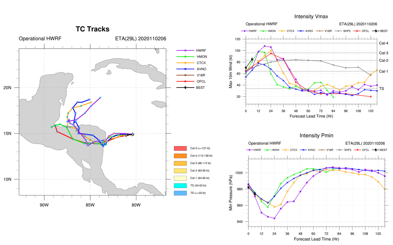
Step 3, check out the regional hurricane model forecast guidance:
Here is the most recent posting on the website for HWRF and HMON (intensity on upper right), with HMON a low Cat 3 and HWRF a high Cat 3. The short black line indicates that the best track is following the growth curves for HMON and HWRF. Official forecast in this forecast interval is taking Eta up to the edge of Cat 3.