-
Preparing for Potential TC Nine
Posted on July 28th, 2020 No commentsNHC 11 am message renamed the disturbance Potential Tropical Cyclone Nine. Prompts us to do a quick tour of the data assimilative global models, Navy GOFS and European Copernicus.
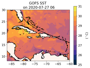
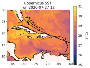
First is GOFS SST, and below it Copernicus SST. Maria has made these new plots easier to interpret. Colors are now in 0.5C increments, with the range tuned to each region. First impression is that Copernicus warmer than GOFS, often by about 0.5 C.


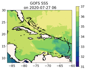
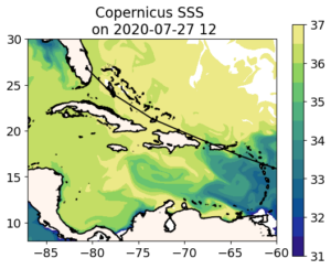
Now for the surface salinity as a proxy look at the barrier layers. Copernicus is generally fresher, possibility with more substantial barrier layers.


Warmer Sea Surface Temperature (SST) and lower sea surface salinity (SSS) in Copernicus mean more potential for intensification with the Copernicus ocean.
Last 5 posts by Scott Glenn
- Early Season in the Mid Atlantic - June 17th, 2021
- Disturbance in the Gulf - June 16th, 2021
- Hurricane Gliders 2021 - May 3rd, 2021
- Hurricane Iota - November 16th, 2020
- Hurricane Eta - Low Wind Shear, High SST - November 2nd, 2020


