-
September 10 SST Imagery
Posted on September 10th, 2018 No commentsWhat a wonderful picture of the bottom layer in GOFS 3.1.
That bottom layer was always an unmet challenge in 3.0.
Perhaps both models are being pulled to a warmer SST by the assimilation of the satellite data.
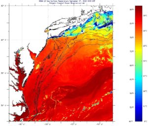
Last good image of the area I have is Sept 7, a couple days before this plot.
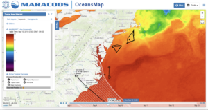
SSTs maybe near 25C, but a little hard to read the color scale.

MARACOOS OceansMap 7-day composite SST also looks to be near that 24C mark.
All good things to investigate with the data assimilators at Stennis.
Scott
Last 5 posts by Scott Glenn
- Early Season in the Mid Atlantic - June 17th, 2021
- Disturbance in the Gulf - June 16th, 2021
- Hurricane Gliders 2021 - May 3rd, 2021
- Hurricane Iota - November 16th, 2020
- Hurricane Eta - Low Wind Shear, High SST - November 2nd, 2020


