


-
Some USVI Glider Data ahead of Isaac
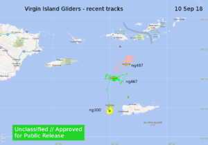
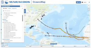
Posted on September 10th, 2018 No commentsAnother couple of images.
First is the location plot for the 3 USVI gliders from the GOC via Doug Wilson.
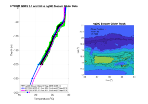
Second is the comparison of NG300 with GOFS 3.1 and 3.0 via Maria Aristizabal.
Also Ben Lacour and John Kerfoot have been looking at the data flow and are seeing the Navy gliders show up in the NCEP data tanks.
More to come tomorrow.
Scott
-
Hurricane Helene and Silbo in the eastern Atlantic
Posted on September 10th, 2018 No comments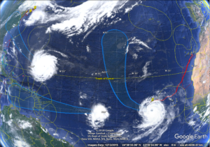
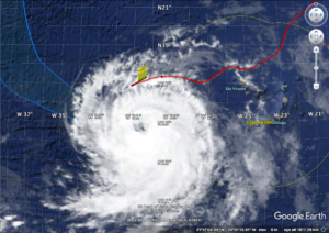
Just wanted to share these images of Helene and Silbo while we were working on the model-data comparisons for ramses and a Navy glider in the Caribbean.
-
September 10 SST Imagery
Posted on September 10th, 2018 No commentsWhat a wonderful picture of the bottom layer in GOFS 3.1.
That bottom layer was always an unmet challenge in 3.0.
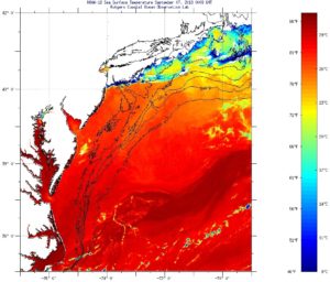
Perhaps both models are being pulled to a warmer SST by the assimilation of the satellite data.
Last good image of the area I have is Sept 7, a couple days before this plot.
SSTs maybe near 25C, but a little hard to read the color scale.
MARACOOS OceansMap 7-day composite SST also looks to be near that 24C mark.
All good things to investigate with the data assimilators at Stennis.
Scott
-
September 10th Glider RU33 GOFS 3.1 and GOFS 3.0 Comparisons
Posted on September 10th, 2018 No commentsComparisons for RU33 in the MAB show that both GOFS 3.1 and GOFS 3.0 are over predicting sea surface temperature.
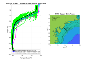
We’ll shortly be adding comparisons to additional gliders deployed throughout the eastern US and Caribbean.
Travis
-
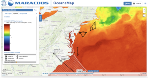
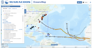
Three Storms in the Atlantic
Posted on September 10th, 2018 No commentsA couple of images for your morning briefs from MARACOOS OceansMap.
Three hurricanes in the Atlantic – Florence, Isaac and Helene.
We have gliders deployed and reporting to the IOOS Glider DAC on the right side of each hurricane.
The first image shows hurricanes and gliders only.
Second turns on the IOOS HFRnet, which unfortunately hides the MAB gliders from view.
So you have to choose one or the other based on your need to highlight gliders or HFR.
Good luck to Catherine on the deployment.
Scott
