-
70 kilometers to pick up point
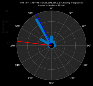
Posted on October 20th, 2018 No commentsWe did some tests flight tests on Friday, and are now back to heading towards the pick up point. The latest measured heading plot shows RU29 is now flying about 60 degrees to the right of the commanded heading.
Below image is zoomed into the local area with the new Copernicus model currents. The direction we want to head is to the NE, at a heading of about 30 degrees. With the 60 degree offset noted above, we can give RU29 a waypoint that is to the NW at a heading of 330 degrees. That new waypoint is shown in the cyan color.
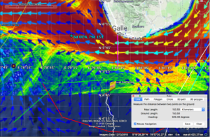
The Copernicus currents show that there is a strong current to the west just south of Sri Lanka in the region with the high vessel traffic. That means there are two hazards if we move into that area, vessels that can hit us and currents that can sweep us away.
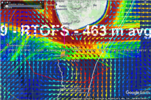
Below is the important model comparison. You always hope the models agree so that you have more confidence in the currents.
First is Copernicus, the European model. There is a strong alongshore current to the west offshore suthern Sri Lanka that covers the shipping lanes in red. RU29 is in a relatively low current zone, near the middle to western side of a counterclockwise eddy. Currents at RU29 are weak ant to the south.
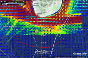
Now for the two US models. First the Navy HYCOM. Here RU29 is on the eastern side of a very strong and elongated clockwise eddy. The elongation is in the direction of altimeter tracks – wish I could overlay them somehow. The strong eddy is disrupting the alongshore flow by southwestern Sri Lanka and turning it to the east. Currents at RU29 are strong and to the southeast.
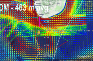
Last is NOAA RTOFs. Same story as Hycom, bit now the eddy is round, not elongated like an altimeter track.
Last 5 posts by Scott Glenn
- Early Season in the Mid Atlantic - June 17th, 2021
- Disturbance in the Gulf - June 16th, 2021
- Hurricane Gliders 2021 - May 3rd, 2021
- Hurricane Iota - November 16th, 2020
- Hurricane Eta - Low Wind Shear, High SST - November 2nd, 2020


