


-
Tropical Storm Zeta
Posted on October 25th, 2020 No commentsThe 11 am National Hurricane Center discussion notes the importance of the ocean impacts on Zeta’s intensity in three locations.
- In the current location, the low shear and high ocean heat content in the western Caribbean favor intensification.
- As Zeta crosses the central Gulf, increasing shear and diminishing ocean heat content is expected to prevent intensification.
- As Zeta approaches the northern Gulf, the unfavorable ocean and atmospheric conditions could cause zeta to weaken beyond what is in the official forecast.
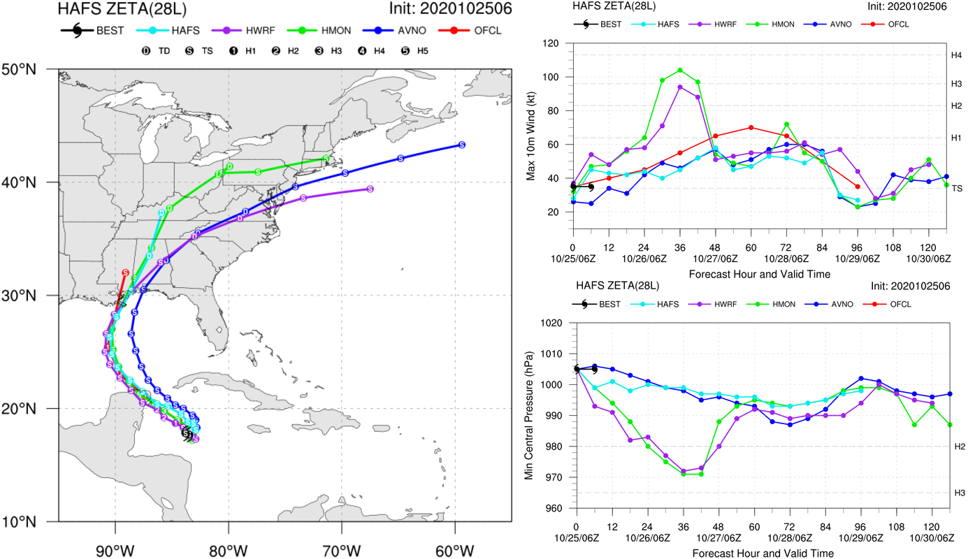
Below is the present regional guidance (HWRF in purple, HMON in green), and what we anticipate will evolve into future guidance, the experimental HAFS model (light blue). The tracks (left image) from these three models have converged since last night, and that makes them easier to compare. Zeta should be going over similar oceans in these models, something to check. On the top right is the intensity plot. The official intensity forecast (red) is above the model consensus. HAFS looks to be below the official forecast, keeping Zeta below hurricane strength as it approaches Yucatan. The operational models are showing the Zeta intensifying as it approaches Yucatan, with HMON going to Cat 3 and HWRF going to a high Cat 2. These models appear to be the ones that include the impact of the high ocean heat content in the western Gulf that the forecasters are saying favor intensification.
Last 5 posts by Scott Glenn
- Early Season in the Mid Atlantic - June 17th, 2021
- Disturbance in the Gulf - June 16th, 2021
- Hurricane Gliders 2021 - May 3rd, 2021
- Hurricane Iota - November 16th, 2020
- Hurricane Eta - Low Wind Shear, High SST - November 2nd, 2020
