


-
Tropical Depression Twenty-Eight
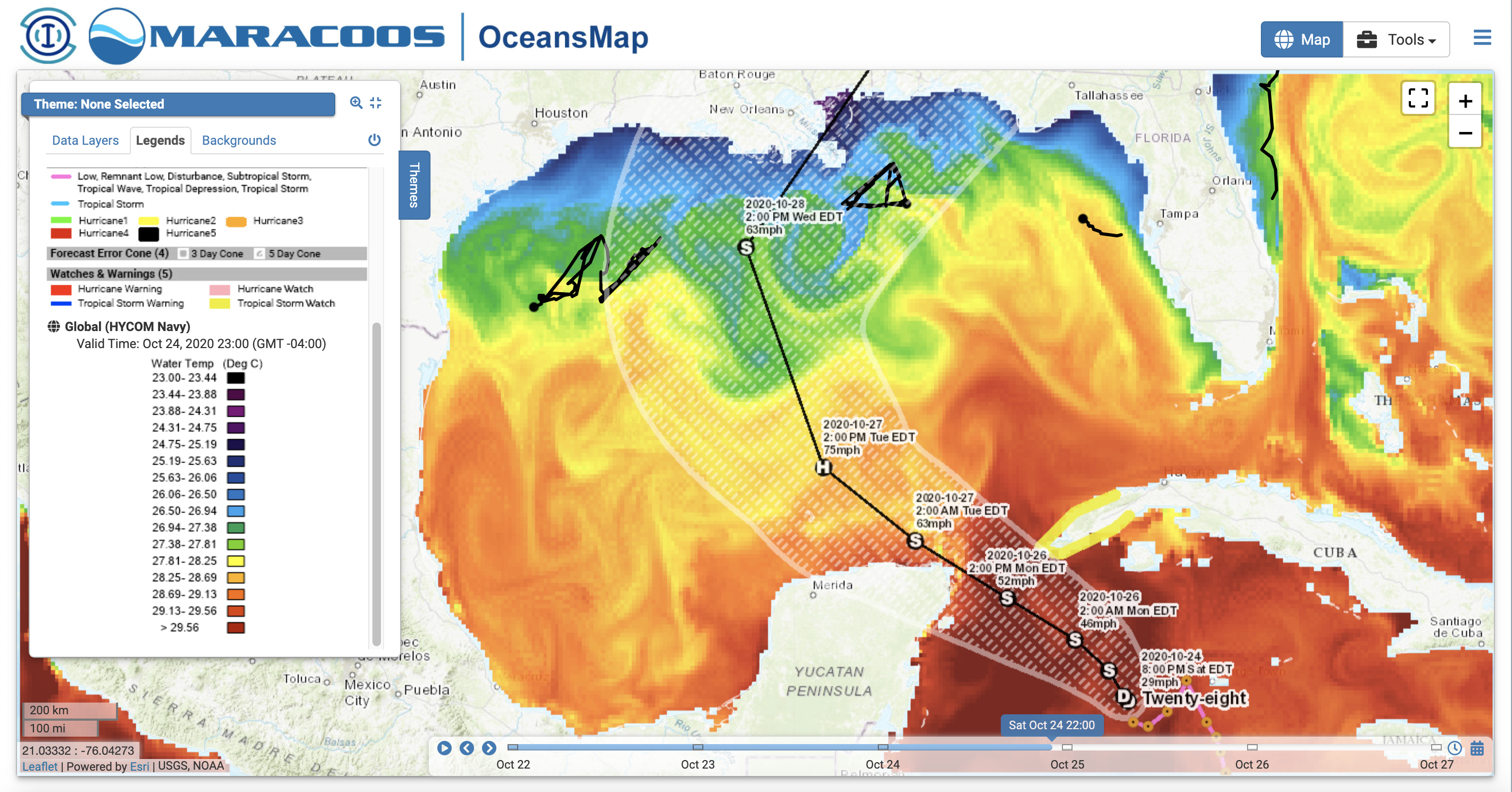
Posted on October 24th, 2020 No commentsThe 5 pm NHC forecast discussion reminds us that as this storm approaches the northern Gulf, the cooler shelf waters and the increasing wind shear will likely weaken this storm.
Lets take a look at those cooler temperatures by checking the Navy’s GOFS model SST. Here we see the official forecast track heading through the Yucatan Straits, with the cooler water way up on the shallow shelf of the northern Gulf. The green colors are still up around 27C, so the darker blues below 26c are really up by the coast.
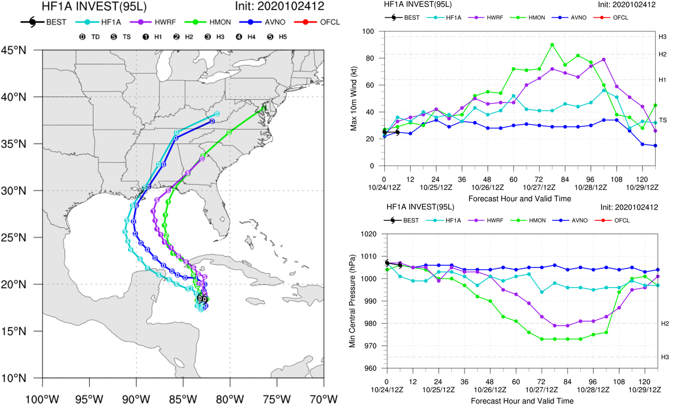
Now lets look at what the forecast guidance is telling us. HWRF and HMON, the two operational regional models, are hugging the right side of the cone, hitting western Cuba and tracking closer to the very warm (near 29C) waters of the Loop Current. Both of these models go to hurricane strength, with HMON hitting Cat 2 for a short period while the tracks are still very close (science question for the winter). If these tracks hold the storm will pass over NDBC’s glider SG601. The experimental HAFS model hugs the left side of the cone, tracking over Yucatan, and the cooler Mid-Gulf waters, remaining below hurricane strength throughout.
Last 5 posts by Scott Glenn
- Early Season in the Mid Atlantic - June 17th, 2021
- Disturbance in the Gulf - June 16th, 2021
- Hurricane Gliders 2021 - May 3rd, 2021
- Hurricane Iota - November 16th, 2020
- Hurricane Eta - Low Wind Shear, High SST - November 2nd, 2020
