-
Five Gliders in a Picket Line
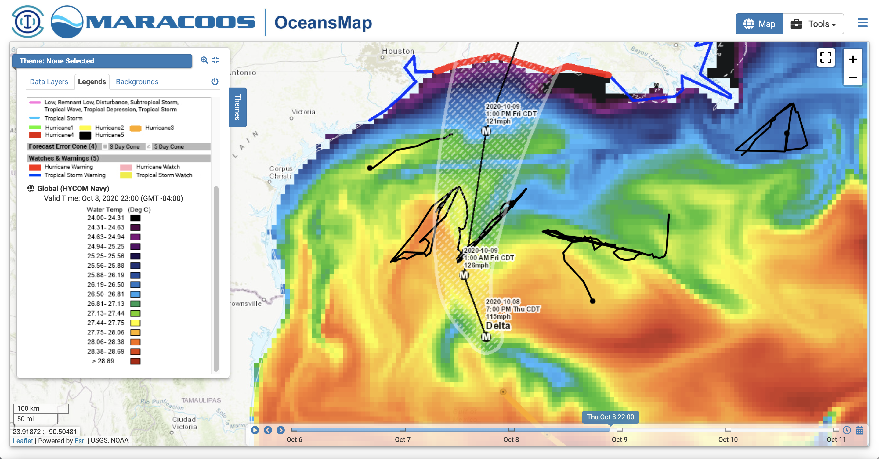
Posted on October 8th, 2020 No commentsFirst a quick view of the northern Gulf the night before landfall of what looks to be a major hurricane. The image below shows the Sea Surface Temperature forecast for the Navy’s data assimilative Global Ocean Forecast System, a consistently high performing ocean model, definitely a good choice for the start of our U.S. hurricane forecast workflow. It nicely demonstrates the value of the hurricane glider picket line concept. These gliders have been deployed for weeks, feeding their data into the GOFS model everyday to do everything we can to put the best representation of the ocean we can underneath our best hurricane models. We have two Texas A&M Gliders on the west, two Navy gliders in the middle, one NOAA glider piloted by USM on the east. Multiple government, university and industry groups working together for the common purpose of generated the best forecasts possible. We call it “Distributed Autonomy”. With sampling distributed in space and time. With operations distributed between multiple shore labs. And sponsorhips distributed between different agencies. What we see below, the pre-storm conditions established by the GOFS model, is one reason why we deploy the Hurricane Glider Picket Line each year – to improve the hurricane models that we are using today to forecast this very storm.

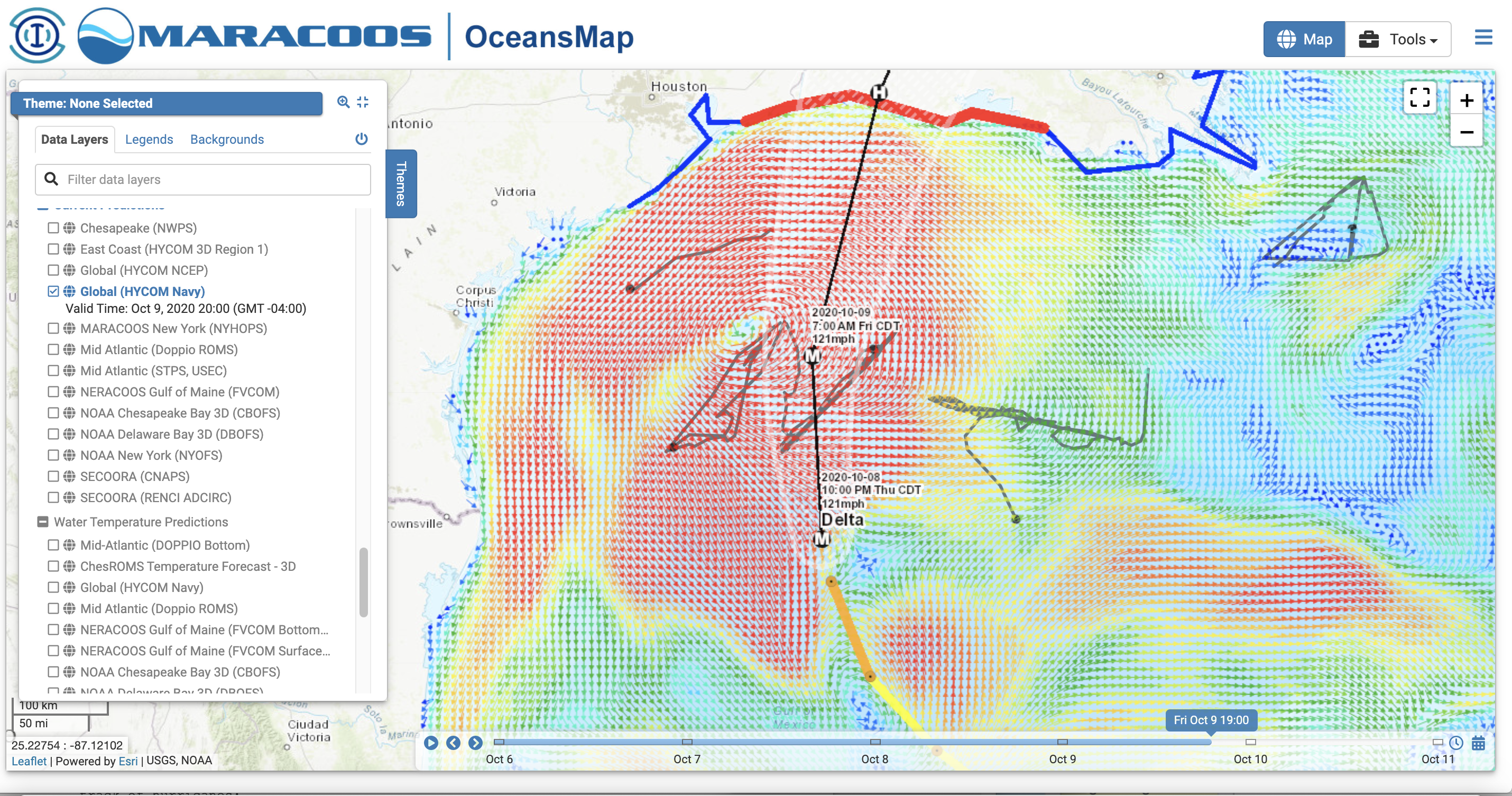
The second reason we deploy the glider picket line each year is shown below. It shows tomorrow’s GOFS forecast of the ocean currents, with the eye of Delta clearly visible a bit to the west of the official forecast, and the ocean current response to the downwelling-favorable winds (remember that blog entry from earlier in the week on upwelling versus downwelling?) along the LA-TX shelf, and we see the size of the storm. Four of the gliders will be directly in the thick of it, gathering the science data that will help us improve the hurricane models of the future. All that data to improve those future models is going to be gathered in the next 24 hours. By robots. No people have to go to sea. We are not overburdening the hurricane hunters and their flight crews. But we are there.

Stay safe Louisiana.
-
When Guidance and Forecasts Align
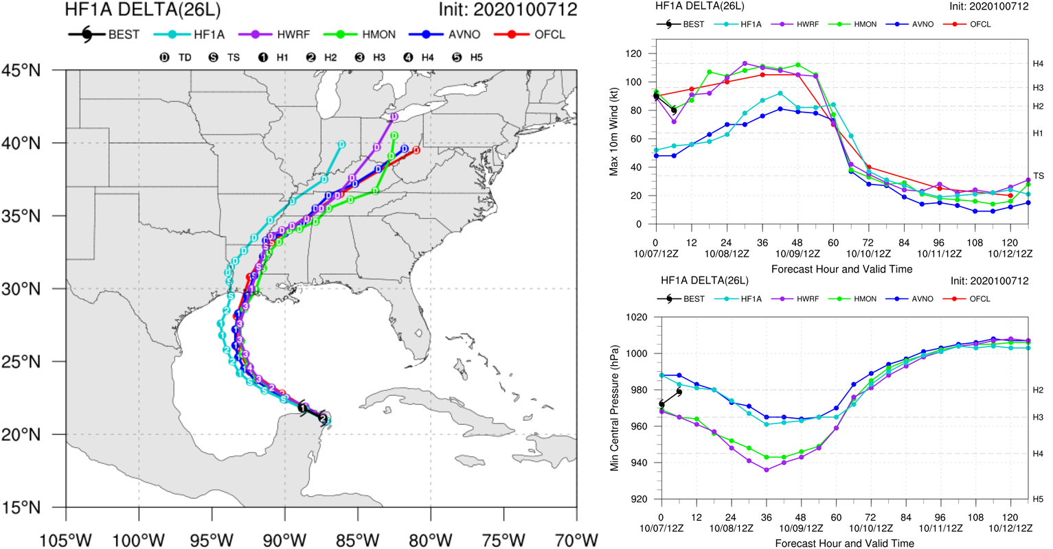
Posted on October 8th, 2020 No commentsAnother morning with remarkable agreement between the two operational regional models (HWRF and HMON) and the official NHC forecasts (red). Both models are skimming the bottom of the Cat 4 wind speed, and the official forecast is putting it in the middle of Cat 3. Not sure why the experimental HAFS model does not have the right initial condition. Something to check over the winter.


